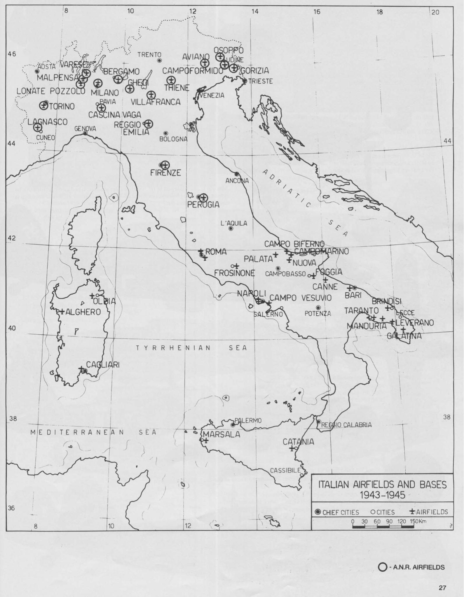
I am currently very much interested at locating photos or maps of the Palata airfield (Italy, Molise regione, province of Campobasso, coordinates 41°52’42.45"N, 14°54’13.81"E) that in its fairly short operational life hosted several air units of the ICAF, RAF and SAAF
The ICAF (Italian Co-belligerent Air Force) units deployed at Palata airfield were:
- the 239^ Squadriglia of 101° Gruppo, of 5° Stormo Caccia flying RE 2002 Ariete” aircraft in Jan 1944
- the 10° Gruppo of 4° Stormo Caccia
- the 20° Gruppo of 51° Stormo Caccia Terrestre flying Macchi MC 202-205 aircraft -8 Mar-29 to Apr. 1944
The RAF deployed at Palata the 241 Squadron (RAF) that moved to Madna by end of Jan and in Feb to Apr. 1944 to Canne.
The S.A.A.F. deployed the following units: - the 1st Squadron S.A.A.F. (Day fighters and ground attack) Oct. 1943 - Dec 1943
- 2nd Squadron S.A.A.F. ( Fighter bombers) Oct. 1943 - Dec 1943
- 4th Squadron S.A.A.F. (Squadron Ground attack) Oct. 1943
I would appreciate any help on this topic.
Many thanks, Red 21